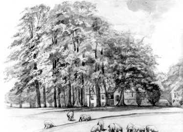
 Charcoal sketch of Baa Lamb Trees – artist unknown – LHS HC 076 A familiar landmark in Harpenden is the group of mature trees which stand on a slight mound in the middle of the narrow part of Harpenden Common just in front of the Harpenden House Hotel. They are known nowadays as the Baa-lamb Trees, but this is probably an instance of folk etymology deriving from the days when sheep were allowed to graze on the Common. The true origin of the name and, indeed, the origin of the trees themselves, invites speculation. A family called Balaam?One suggestion for the origin of the name is that it is an altered form of the personal name Balaam(1) and this suggestion does in fact point to a possible explanation of how the trees came to be there. There has been property associated with the name Balaam in Harpenden for at least three hundred years. Our earliest reference is in the will of Richard Sheppard, written in 1652 and proved in 1653 (2) in which he left to his son Robert, “the house I now dwell in called and knowne by the name of Balams and all the freehold land thereunto belonging lyeing and being in Harpenden in the p(ar)ish of Whethamstede in the County of Hertford and one peece of freehold land lyeing in the Lie Common in Redbome in the County aforesaid”. An entry in the Feet of Fines for Michaelmas 1695 records that Robert Shepherd and Mary his wife transferred “Messuage and lands in Harpenden and Redboum” to Richard Hale (3). In 1716, Richard Hale, by a codicil to his will charged his estate called Balambs (sic) in the parishes of Redboum and Harpenden with the yearly sum of £10-8s towards a charity (4). There is then a gap in our information until 1764 when Mr Edward Hawkins was assessed for land tax on “Bailams” (5). The property remained with the Hawkins family until after 1851, during which time the name had changed to Bylands. Bylands House stands today about half a mile outside Redbourn village on the right hand side of the A5 going north. 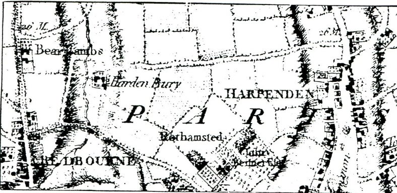 Extract from Drury & Andrews map, showing Bear Lambs just north of Redbourn on Watling Street The Drury and Andrews map of 1766 shows a building there which it calls “Bear Lambs”. There are two slightly earlier maps, dated 1721 (6) and 1753 (7) respectively which cover that area in some detail. They are estate maps of “Kennesbame Manor”, Harpendenbury Farm as it is now, on a scale of about 8″ to the mile and the field boundaries can be clearly seen. The 1753 map has the fields around what is now Bylands labelled “Bailams Farm”. The 1721 map shows the same field pattern although the fields are not named. The field pattern is essentially the same as that shown on the current Ordnance Survey map. On both the estate maps the field where Bylands House stands now can be clearly identified, but no buildings are shown there on either map. On the evidence of the maps then it would seem that the house shown at “Bear Lambs” on the Drury and Andrews map of 1766 had not been built when the earlier maps were drawn. The present house at Bylands is relatively modem but it does have a brewhouse attached which has been dated to the 18th century, so this, as far as it goes, supports the evidence of the maps. On the other hand, Richard Sheppard was living in a house called Balams in 1652, so if there was no house at Bylands at that time we have to find another location for his house. Signs of structures on Harpenden Common?Returning to the Baa-lamb Trees, the drought of 1976 produced an interesting effect around the trees in the form of a ring of scorched grass running round the outside of the trees about 120ft in diameter. On the side nearest to the A1081 there was a break in the ring and a long low mound, running at right-angles to the road entered the ring through the gap. If we look at Drury and Andrews map of 1766, at the place where the Baa-lamb Trees are now, we see a curious little device. This is a roughly circular ring, about 3mm across on the map. On the side facing the A1081 the ring is indented. Inside the ring are a number of irregular black shapes but the scale of the map is too small to decipher what these are meant to be. It is apparent that the remains of whatever is represented on the map were the cause of the scorched grass marks which appeared during the drought and it seems likely that the feature was a walled enclosure, with an entrance facing onto what is now the A1081. This entrance would account for the indentation shown on the map at that position and for the break in the ring of scorched grass. The long low mound running into the gap would then be the remains of a metalled driveway. On this assumption, while his house was on [Harpenden] Common, his farmland was over near Redbourn. Sometime in the middle of the 18th century whoever possessed the farm at that time would seem to have had a new house built on the site of the present Bylands. Consequently the house on the Common would be abandoned. The timber-framed buildings would be cannibalised to extend or repair other buildings around the village. The walled enclosure would become overgrown with weeds. Seedling trees would plant themselves and eventually grow into the mature trees we see today. Balams House would become the Baa-Lamb Trees. And the Baa-Lamb Trees have attracted numerous local artists, in winter and summer, and – in the past – they have given shelter to Gypsy caravans. |
References:
- (1) Scattergood, St Albans Archit. & Archaeol.Soc. Trans. 1935 p.282
- (2) Public Record Office, Prob.II 225
- (3) Scattergood, St Albans Archit. & Archaeol.Soc. Trans. 1934 p.204
- (4) V.C.H. Herts II p.515
- (5) Herts Record Office, Wittewronge Papers I, p.252
- (6) Herts Record Office, D/ELW.PZ
- (7) Westminster Abbey Muniments Map no. 12479
Christmas card by Donald F Merritt – HC 021
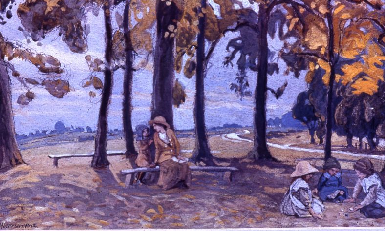
Ernest Heasman – Scan B 3.8

Ernest Hasseldine, 1923 – B 3.88
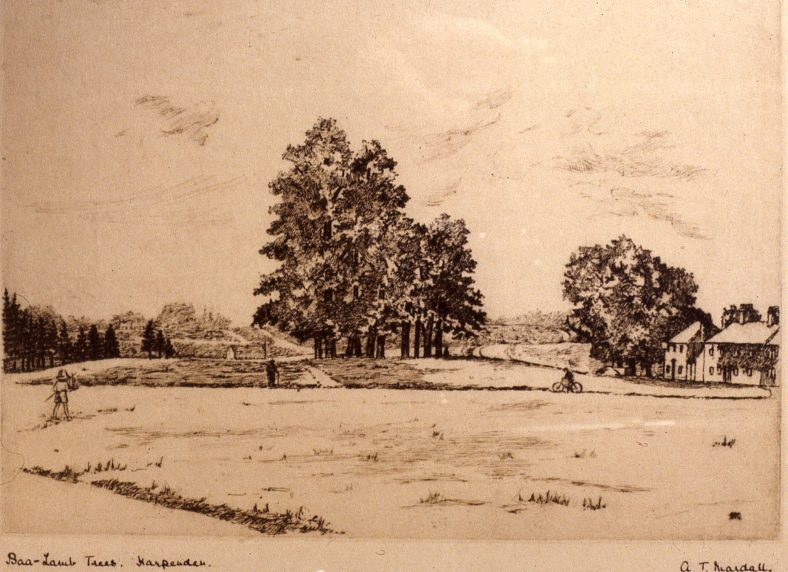
A T Mardall, c.1900 – B 3.83

Sketch, with St Albans Road and pond, 1880s – B 1.65

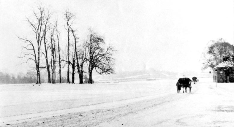
Gypsy caravans on the common by the Baa Lamb Trees, c.1900 – B 2.37
Comments about this page
An interesting history of the “Baa Lamb” trees and how they were originally named. ( My father worked at Bylands Motor Garage on the old A5 north of Redbourn just after the WW2 period.) It seems that Bylands garage would have been near to “Balams Farm”
Add a comment about this page